Diagnose
Identify failure zones, erosion vectors, and drainage behavior using terrain and watershed indicators.
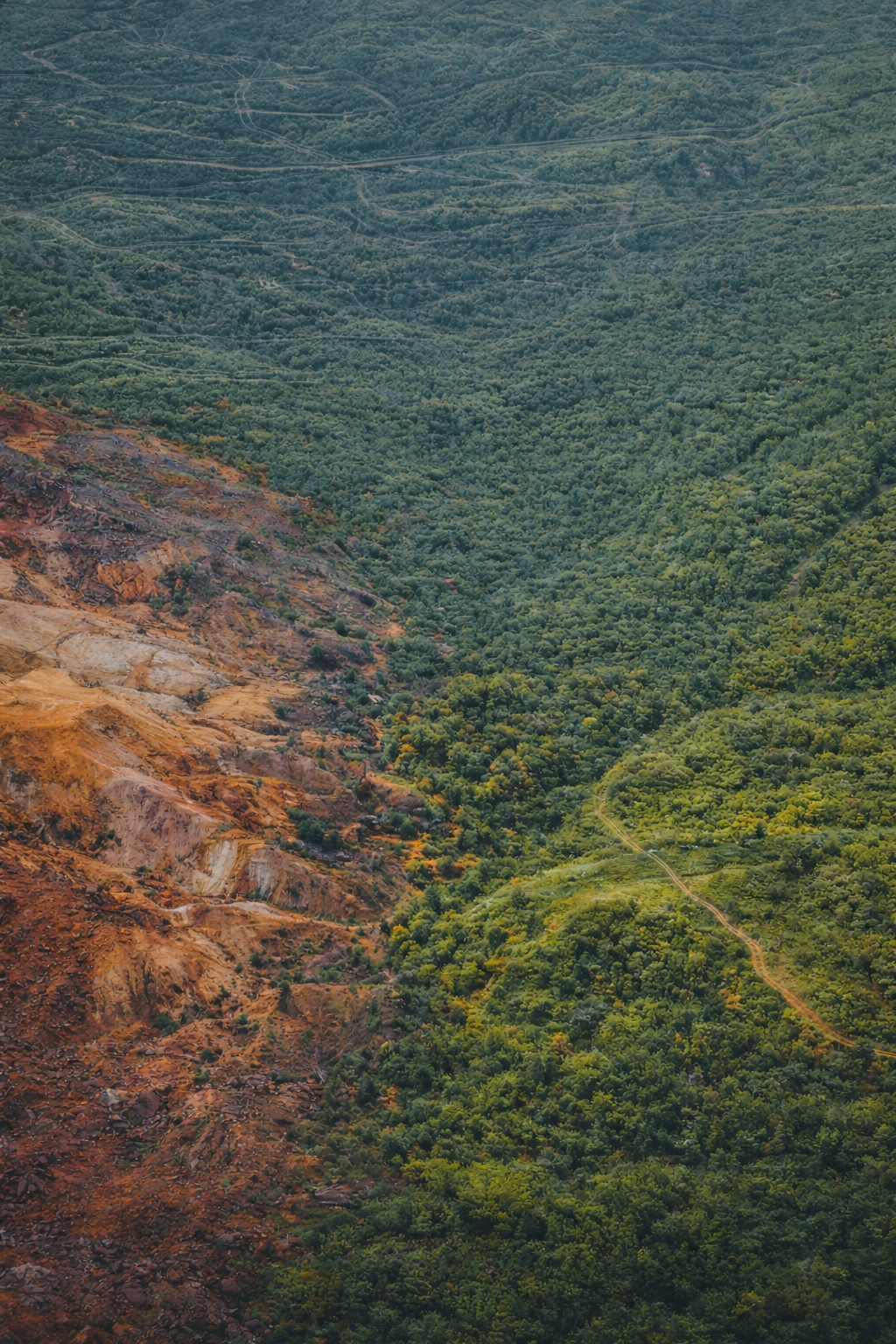
Mine Reclamation should be proven with observable land behavior—not just paperwork. We teach, measure, and validate reclamation using Google Earth Engine and repeatable indicators of terrain stability, hydrologic function, and seasonal persistence without ongoing intervention.
Start with the standard, browse the courses, and use the library for guides and metrics.
A practical framework for evaluating land stability after mining disturbance.
Mine reclamation should be judged by how land actually behaves, not by paperwork or appearance. At the Land Function Institute we teach a framework for restoring disturbed landscapes through measurable land performance.
Instead of relying only on visual inspections, we analyze terrain stability, hydrologic routing, sediment movement, and vegetation persistence across seasons. When a reclaimed landscape regulates itself naturally after disturbance, the system has recovered.
⸻
Modern mine reclamation must move beyond cosmetic grading and short-term revegetation. A reclaimed landscape should remain stable through storms, drought, and seasonal change.
Our approach combines field observation with geospatial analysis. This allows us to determine whether drainage systems function correctly and whether slopes remain stable over time. These indicators provide clear evidence that land systems are functioning again.
⸻
The Land Function framework uses modern geospatial tools such as
Google Earth Engine to analyze terrain structure, watershed behavior, and vegetation response.
These tools help professionals identify erosion patterns early. They also reveal drainage failures before instability becomes permanent.
⸻
To understand the methodology, begin with the Land Function Standard.
Next, explore the applied training offered in our courses.
These programs teach practical techniques for identifying erosion vectors, diagnosing drainage problems, and verifying whether reclaimed terrain stabilizes across seasons.
⸻
You can also explore the
research and publications library for guides, definitions, and case studies related to reclamation diagnostics.
These materials explain the difference between cosmetic repair and true environmental recovery.
⸻
The goal of the Land Function Institute is simple. We want land restoration to be measurable.
When terrain, water systems, and vegetation remain stable year after year, restoration has succeeded. If a site requires constant maintenance, the land system has not yet recovered.
We turn reclamation into measurable, repeatable proof.
Identify failure zones, erosion vectors, and drainage behavior using terrain and watershed indicators.
Support landform and hydrologic redesign so systems stabilize through self-regulation, not maintenance.
Validate success across seasons with observable indicators—repeatable, defensible, and practical.
Restoring land systems through measurable stability.
To teach, measure, and validate mine reclamation using Google Earth Engine and observable land behavior across terrain, water, and vegetation systems—proving that stability can be predicted, implemented, and sustained without ongoing intervention.
A world where mine reclamation is judged not by paperwork, but by self-sustaining land performance across seasons.
Three pillars define how we diagnose, design, and prove reclamation success.
Reclamation is not cleanup. It’s redesign. We use geospatial diagnosis to identify failure zones, erosion vectors, drainage behavior, and long-term stability risks before work begins.
The SOP defines how the method is applied consistently in the field.

Defines the standard operating procedures for applying the method consistently, documenting observations, evaluating site conditions, and producing repeatable reclamation assessments.
Applied training built around observable proof, not opinion.
Applied satellite analysis for terrain correction and hydrologic stability.
Detect slope instability, sediment transport, and erosion vectors before collapse.
Use watershed behavior to design stable post-mining landforms.
Plants confirm stability—but they don’t create it.
Model long-term erosion, dispersion, and containment risk.
Go beyond checklists with measurable land behavior evidence.
Full lifecycle: disturbance → correction → validation → persistence.
Prove success across 3–5 seasonal cycles using repeatable indicators.
Support for operators, agencies, educators, and closure teams—built on measurable stability.
Independent stability assessment using terrain and hydrologic indicators derived from geospatial evidence.
Model failure zones and drainage behavior to prevent long-term instability and repeat fixes.
Evidence packages built from observable land behavior across seasons—repeatable and defensible.